The Sunshine Coast is one of the most beautiful places in Australia, and it’s an excellent holiday spot for families. With so many trails and parks to explore, you might have a difficult time choosing just one! Don’t worry; we’ll walk you through six pram friendly walks on the Sunshine Coast. We’ll also look at the benefits of walking with your baby.
Key Points
- Russell Family Park is one of the best pram friendly walks on the Sunshine Coast
- Noosa National Park is a wonderful option if your children love wildlife
- Mapleton Falls National Park is surprisingly pram friendly and offers magnificent views of the Obi Obi Valley
Content In This Article:
- Noosa National Park
- Conondale National Park
- Currimundi Lake Conservation Park
- Mapleton Falls National Park
- Mary Cairncross Scenic Reserve
- Buderim Forest Park
- Kondalilla National Park
- Russell Family Park
- Why Should You Prioritise Taking Walks With Your Baby?
- Conclusion
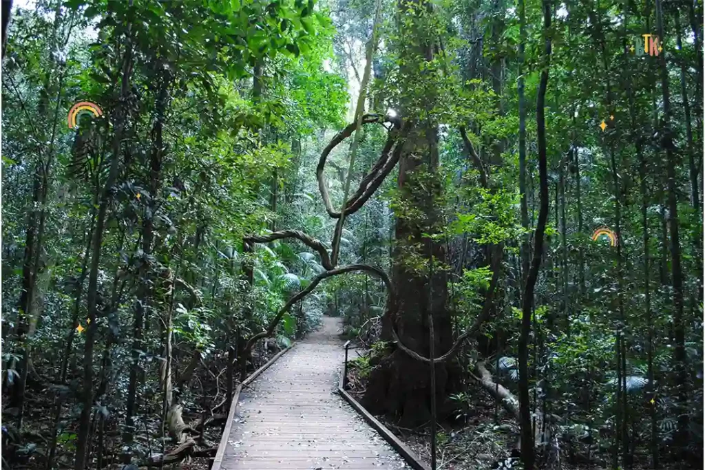
Noosa National Park
Location: Palm Grove Cct, Noosa Heads QLD 4567, Australia
Getting there: Get directions to Noosa National Park
Walking map download: View here
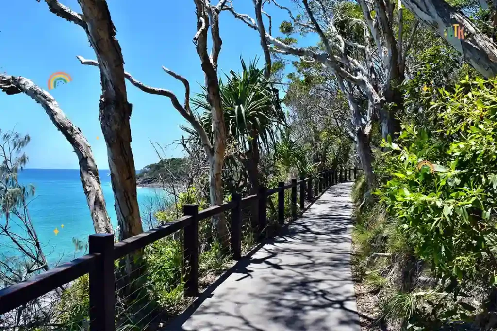
Noosa National Park is a beautiful wildlife sanctuary near the Sunshine Coast, where you can visit to see all the good the refuge is doing. Things here are continually being improved, so every visit features new attractions and beneficial programs to marvel at.
While the animals are undoubtedly a big draw for the Noosa National Park, you can also find an eucalypt forest, melaleuca wetland, and even a rainforest walk here!
How Long Does It Take To Walk Around Noosa National Park?
Palm Grove walk is one of the best for pram accessibility, and this is a 1.1 km walk return. This should take you around 30 to 60 minutes, and you’ll end where you started – right next to the car park! The longer Coastal Walk is also pram friendly, which is a much longer 10.8 km! This will take you hours, although you don’t have to complete it all in one go.
What Facilities Does Noosa National Park Have?
Toilets: There are several toilet blocks for you to use around Noosa National Park.
Kids playground: There are currently no playgrounds at Noosa National Park.
Parking: There is a day-use parking area for national park visitors.
Public transport access: There are three bus stops around Noosa National Park, with the closest being on Noosa Pde.
Wheelchair accessibility: There are several wheelchair accessible routes around Noosa National Park.
Conondale National Park
Location: Conondale QLD 4552, Australia
Getting there: Get directions to Conondale National Park
Walking map download: View here
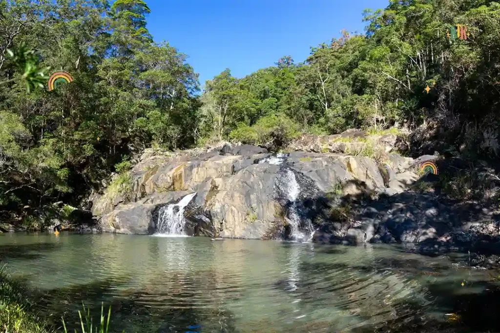
The Conondale National Park is another fantastic option to take your little one to, with plenty of rare wildlife and plants to see. Some are even endangered, making them even more of a sight to behold! Besides that, there are plenty of creeks, rainforest walks, and waterfalls to see.
The Conondale National Park spans 35,700 hectares, so you won’t be able to see it all in one day. But that just gives you another reason to visit the Sunshine Coast again!
How Long Does It Take To Walk Around Conondale National Park?
The main walk around the Conondale National Park is called the Great Walk, and it’s 56 km long! Of course, this probably won’t be achievable for your family in one day. So, you can make your walk around this national park as long or as short as you like – simply turn around when you’ve had enough!
What Facilities Does Conondale National Park Have?
Toilets: There are several toilet blocks located around Conondale National Park.
Kids playground: There are no playgrounds at Conondale National Park.
Parking: You have two parking options, either near Peters Creek or Booloumba Falls.
Public transport access: The nearest bus stop to Conondale National Park is Gizerah St, near Mashobra St, Stop 11.
Wheelchair accessibility: There are accessible areas within Conondale National Park for wheelchair users to enjoy.
Currimundi Lake Conservation Park
Location: Wurtulla QLD 4575, Australia
Getting there: Get directions to Currimundi Lake Conservation Park
Walking map download: View here
Currimundi Lake is not actually a lake at all, but actually the mouth of Currimundi Creek. The creek often develops a barrier between the ocean and the rest of the stream, making it look more like a lake. These sandbanks need to be broken down by the local council so that the water can escape back into the ocean.
The walks around the lake/ creek are relatively short, making them wonderful for family trips with a pram. Most of the trails go through the Wallum heathland, where you can try your hand at bird spotting. Look out for the many species of coastal birds that reside here!
How Long Does It Take To Walk Around Currimundi Lake Conservation Park?
There are two main trails around the Currimundi Lake Conservation Park. The first is the Health Circuit, and this is a 1.4 km return, taking around 40 minutes to complete. The track is hardened and therefore suitable for prams, and it’s relatively flat all the way around. The second is the Beach Access Track, which is slightly longer at 2 km return, taking around two hours to complete.
What Facilities Does Currimundi Lake Conservation Park Have?
Toilets: There are public toilets within the car park at Currimundi Lake Conservation Park.
Kids playground: There is no playground at the Currimundi Lake Conservation Park.
Parking: There is a designated car park for Currimundi Lake Conservation Park, as well as on-street parking further down the road.
Public transport access: The bus is the best way to get to Currimundi Lake Conservation Park if you’re looking for a public transport alternative to driving.
Wheelchair accessibility: The first 130 metres of the track is wheelchair accessible, ending at a lake lookout.
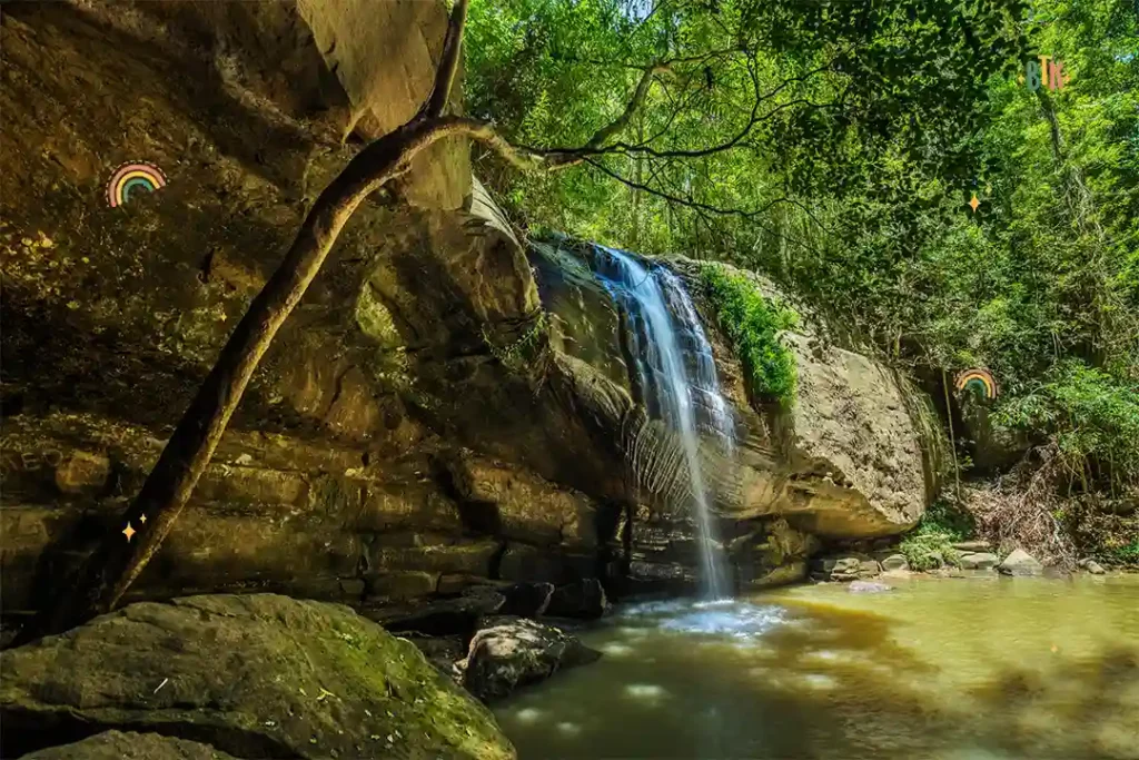
Mapleton Falls National Park
Location: 78 Mapleton Falls Rd, Mapleton QLD 4560, Australia
Getting there: Get directions to Mapleton Falls National Park
Walking map download: View here
Mapleton Falls National Park has breathtaking views of the Obi Obi Valley. Despite many of the trails featuring stark drops and deep ravines, this national park is surprisingly accessible for prams.
The rainforest walks offer the perfect bushwalking experience without being dangerous for pram users, which is exactly what people visiting the Sunshine Coast often want. The Mapleton Falls Lookout Track offers amazing views and wonderful picture opportunities and is completely pram friendly.
How Long Does It Take To Walk Around Mapleton Falls National Park?
The Mapleton Falls lookout walk is a simple one with a return distance of 50 metres, which will take around five minutes each way. This ends at the lookout, which gives you breathtaking views of the park! A longer walk can be found at the Mapleton Falls trailhead, signposted Wompoo circuit. This trail is a 1.3 km return and will take 45 to 60 minutes.
What Facilities Does Mapleton Falls National Park Have?
Toilets: The toilets are located at the beginning of the trail, near the car park.
Kids playground: There is no playground at Mapleton Falls National Park.
Parking: At the start of the Mapleton Falls National Park trail, there is designated parking for guests.
Public transport access: There are no public transport options available for visiting the Mapleton Falls National Park.
Wheelchair accessibility: Wheelchair users can access the Mapleton Falls lookout.
Mary Cairncross Scenic Reserve
Location: 148 Mountain View Rd, Maleny QLD 4552, Australia
Getting there: Get directions to Mary Cairncross Scenic Reserve
Walking map download: View here
Mary Cairncross Scenic Reserve is a beautiful forest walk that you can easily push a pram over while enjoying everything this spot has to offer. The walk is no longer than 1.5 km, which is ideal for families with young children! While you’re there, make sure you look out for the Pademelon – and don’t forget to check out the playgrounds and picnic areas to make a full day of it.
How Long Does It Take To Walk Around Mary Cairncross Scenic Reserve?
There are three internal circuits within the Mary Cairncross Scenic Reserve, including the Rainforest Loop, Pademelon Loop, and Piccabeen Loop. These are all between 1.3 and 1.7 km long, and should take no longer than 90 minutes to complete. There are also shorter walks to consider, the Glider Gallery boardwalk and the Butterfly Walk. These will take around 30 minutes to complete.
What Facilities Does Mary Cairncross Scenic Reserve Have?
Toilets: Multiple toilet blocks are dotted around the Mary Cairncross Scenic Reserve trails.
Kids playground: You can find the children’s playground along the Butterfly Walk, along with a lawn for your little one to run around on.
Parking: There is a large car park designated for Mary Cairncross Scenic Reserve visitors.
Public transport access: There is limited public transport around Mary Cairncross Scenic Reserve, although you can get a train and bus near the entrance.
Wheelchair accessibility: Wheelchair users can access the Rainforest Discovery Centre, the Glider Gallery boardwalk, and the Butterfly Walk.
Buderim Forest Park
Location: Quorn Cl, Buderim QLD 4556, Australia
Getting there: Get directions to Buderim Forest Park
Walking map download: View here
Otherwise known as Serenity Falls, the Buderim Forest Falls is often considered one of the Sunshine Coast’s hidden gems. The park is at the bottom of Buderim Mountain, and you’ll usually get to see experienced hikers climbing up the giant peak. However, there is still plenty to do at the mountain’s base, with picnic areas, playgrounds, and waterfalls to explore.
How Long Does It Take To Walk Around Buderim Forest Park?
The Circuit Track is the shorter option, taking around 20 minutes to walk the loop. However, take the Walking Track for a longer walk, as this route takes an hour. This is a straight line, so you’ll need to turn around after 30 minutes and walk all the way back.
What Facilities Does Buderim Forest Park Have?
Toilets: The toilets are located at the park entrance, next to the car park of the Buderim Forest.
Kids playground: There is currently no playground at Buderim Forest Park.
Parking: You’ll find the designated parking for Buderim Forest Park at the start of the trail, next to Buderim White House Bed and Breakfast.
Public transport access: You can get to Buderim Forest Park by bus.
Wheelchair accessibility: Wheelchair users can access the boardwalk and lookout points.
Kondalilla National Park
Location: Kondalilla Falls Rd, Flaxton QLD 4560, Australia
Getting there: Get directions to Kondalilla National Park
Walking map download: View here
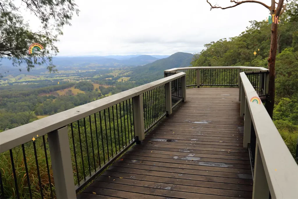
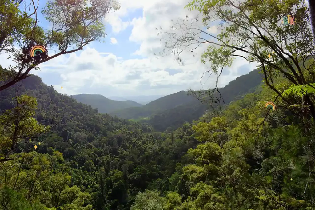
Kondalilla National Park is one of the loveliest areas to visit along the Sunshine Coast, featuring one of the most spectacular views from the Blackall Range’s waterfalls. You’ll be able to see Skene Creek, which is 90 metres of space between you and the luscious rainforest valley below. Once you’re finished looking at the magnificent valley, there are plenty of walking tracks, playgrounds, and picnic areas to rest in.
For parents looking for a pram friendly walk with the best views possible, we would highly recommend Kondalilla National Park!
How Long Does It Take To Walk Around Kondalilla National Park?
The Picnic Creek Circuit will be the best for prams; this walk is 1.7 km. This should take you between 60 and 90 minutes, although you can expect to be slowed down by all the amazing views you’ll be able to see!
What Facilities Does Kondalilla National Park Have?
Toilets: There is a toilet block within the Kondalilla picnic area, which is opposite the car park.
Kids playground: There is a small playground near the picnic area at Kondalilla National Park.
Parking: There is designated parking at Kondalilla National Park.
Public transport access: Some buses come near the entrance of Kondalilla National Park, and there is also parking for buses in the car park.
Wheelchair accessibility: There are several spots within the Kondalilla National Park that are accessible for wheelchair users.
Russell Family Park
Location: Main St, Montville QLD 4560, Australia
Getting there: Get directions to Russell Family Park
Walking map download: View here
Another hidden gem along the Sunshine Coast you can find Russell Family Park in Montville. The park has been recently developed and boasts not one but two lakes with a winding walking path along them. There are plenty of playgrounds and grasslands for children to play on, a cool windmill to explore and some fantastic explanations about our ecosystem.
This is a beautiful day out for families with both young and older kids. Come rain or shine, your trip to Russell Family Park won’t dwindle, thanks to the barbecue stations and shelters.
How Long Does It Take To Walk Around Russell Family Park?
The Russell Family Park offers a very short loop, perfect for tired parents who want a chilled day. The loop around the lake is around 0.6 km, taking between 10 and 20 minutes to complete. It might take longer if your little one is stopping to look at a lot of the wildlife!
What Facilities Does Russell Family Park Have?
Toilets: There are accessible toilets at Russell Family Park.
Kids playground: Russell Family Park features a large playground that kids of all ages can enjoy.
Parking: There is off-street parking at Russell Family Park.
Public transport access: Russell Family Park is located off Main Street in Montville, where there is plenty of bus access.
Wheelchair accessibility: Russell Family Park is accessible for wheelchair users.
Why Should You Prioritise Taking Walks With Your Baby?
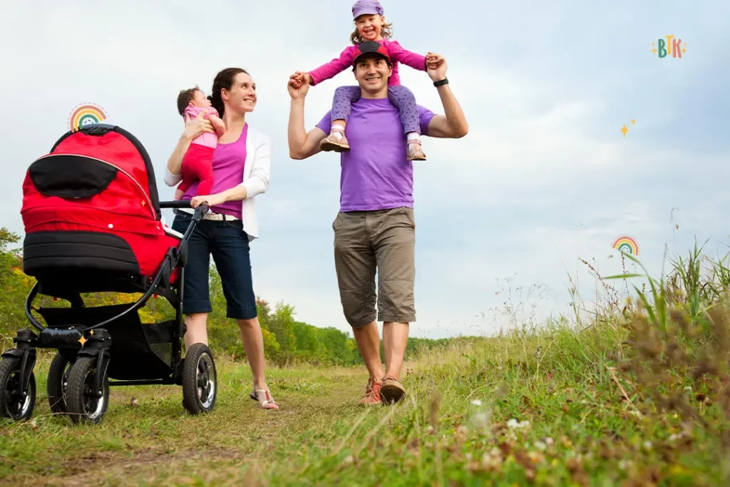
There are many reasons why taking a walk with your baby can be a wonderful experience for you both. The Sunshine Coast boasts a fantastic number of places to explore, and you probably won’t want to miss out on any of them! So, taking your baby on a walk in their pram can help the family make the most of your holiday without having to work around nap times!
There are so many gorgeous sights to behold on the Sunshine Coast, such as luscious rainforests, sand dunes, waterfalls, and more. As they say, nature is one of the best healers, so taking your baby to experience these places can make you both feel more relaxed and refreshed.
Taking your child on holiday with you means that you’re making memories that you’ll remember for a lifetime – and your baby will have all of the beautiful pictures to look back on when they’re older. Taking a walk is a cost-effective way of making these memories without having to worry about a budget.
No matter why you decide to take a walk with your little one, one thing is for sure – a walk anywhere along the Sunshine Coast will be one that you never forget.
Final Thoughts On Pram Friendly Walks Sunshine Coast
There are an incredible number of benefits to taking your little one on a walk with you along the Sunshine Coast. What’s more, there are plenty of places to explore in this beautiful area. Whether you’re planning a trip to the Sunshine Coast soon or are just searching for possible ideas, we hope we’ve inspired you to visit one of these magnificent walking spots on the Sunshine Coast.