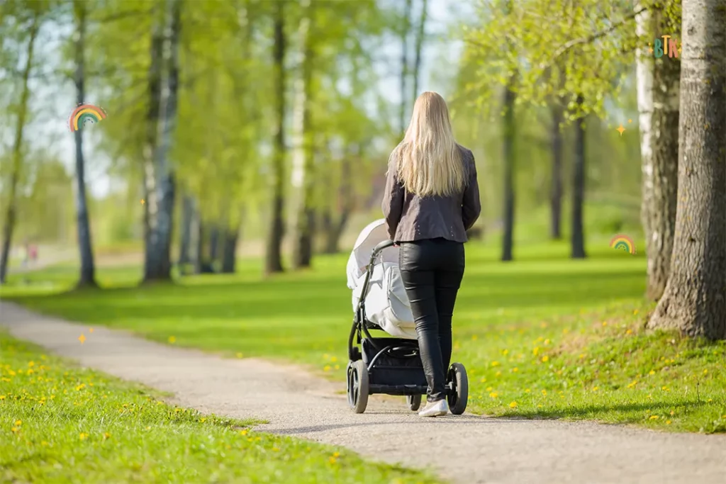
Taking your little ones out and about in nature is a great way of developing their senses, getting some fresh air, and bonding with them. Today, we’ll be taking a look at the best pram friendly walks in Adelaide, looking at how long they take to complete, the amenities you’ll find along the way, and everything else you need to know about each of them.
Key Points
- Most national parks in Adelaide offer amenities like a nature play space, picnic area, and car park, and they are the perfect spot for a scenic family day.
Content in this article:
- Black Cliff Lookout
- Morialta Falls Valley Walk
- Wood Duck Walk
- Lake Discovery Loop
- Punchbowl Lookout Trail
- Lorikeet Loop Walk
- Steub Trail
- Fourth Creek Trail
- Wetlands Loop Trail
- Goondooloo Ridge Walk
Black Cliff Lookout

Location: Black Cliff Lookout, Hallet Cove Conservation Park, Hallett Cove, SA 5158
Getting there: Get directions to Black Cliff Lookout
Walking map download: View here
Located within Hallett Cove Conservation Park, Black Cliff Lookout offers some incredible coastal views and has plenty to keep young families entertained along the way, including a playground and a cafe.
Black Cliff Lookout is a 1.8km trail, making it a good choice for parents looking for a short trail, and it also starts directly from the car park. The pathways are completely paved, making it really easy to push a pram around, and as the trail runs in a loop, there’s no need to turn back once you reach the lookout point.
How Long Does It Take To Walk Around Black Cliff Lookout?
Most people are able to complete the 1.8km round trail in less than two hours. It would be worth allocating more time, however, if you’re planning to use the playground or stop at Boat Shed Cafe.
What Facilities Does Black Cliff Lookout Have?
Toilets: Public toilets and baby changing facilities can be found all along the trail.
Kids playground: Playground facilities are available at Heron Way Reserve, including climbing nets, swings, and a sandpit.
Parking: Free parking is available at the entrance of Hallett Cove Conservation Park
Public transport access: You can reach the park easily by bus from Adelaide city centre.
Wheelchair accessibility: The Black Cliff Lookout trail is wheelchair accessible. However, the trail beyond is not.
Morialta Falls Valley Walk

Location: Morialta Conservation Park, Morialta Falls Rd, Woodforde, SA 5072
Getting there: Get directions to Morialta Falls Valley Walk
Walking map download: View here
With hard-packed gravel paths and a wide boardwalk on the final section, the Morialta Falls Valley Walk is a super easy 1.6km trail that is ideal for pram walks. It’s also one of the most beautiful walks you can find in Adelaide, with waterfall views and loads of nature to enjoy with your little one.
Set within the Morialta Conservation Park, you’ll also find the famous Mukanthi Playspace here, which is a huge area full of play equipment that is ideal for those days when you need your kids to burn off some excess energy!
How Long Does It Take To Walk Around Morialta Falls Valley Walk?
The route at Morialta Falls Valley Walk takes around 45 minutes to complete, although you may want to set some extra time aside for your children to enjoy the Makanthi Playspace.
What Facilities Does Morialta Falls Valley Walk Have?
Toilets: Toilet blocks with wheelchair accessible toilets can be found at the Mukanthi Playspace and the First Falls car park.
Kids playground: The Mukanthi Playspace can be found here, featuring equipment suitable for young families and children of all ages.
Parking: A total of eleven car parks can be found at Morialta Conservation Park, located at the National Resource Centre, Stradbroke Road, and First Falls.
Public transport access: The easiest way to get to Morialta Conservation Park via public transport is by taking the H30 bus from West Lakes to Paradise Interchange, disembarking at Stop 27 on Stradbroke Road.
Wheelchair accessibility: Morialta Falls Valley Walk is wheelchair accessible and has compacted gravel paths.
Wood Duck Walk
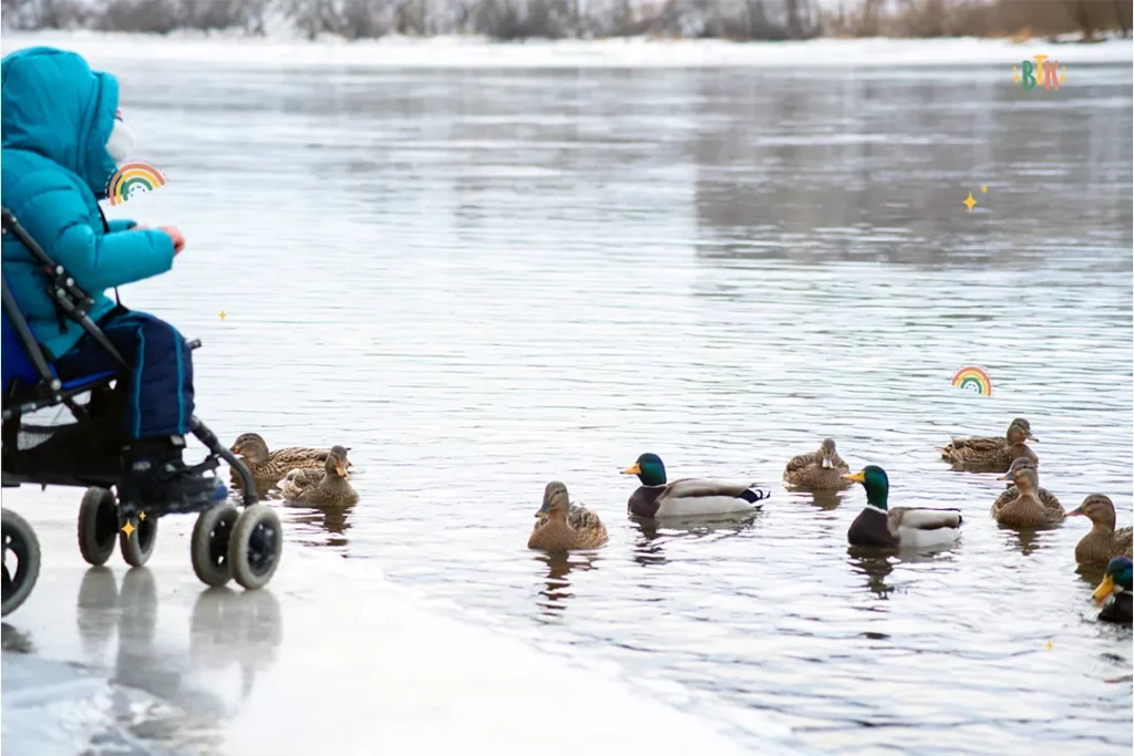
Location: Belair National Park, Upper Sturt Rd, Belair SA 5052
Getting there: Get directions to Wood Duck Walk
Walking map download: View here
Situated in Belair National Park, Wood Duck Walk runs for 1km, and starts at the carpark and Playford Lake picnic area. So, while it is a short trail, you’re never too far from something to keep your children interested (or from the car should you have to make a swift exit!)
One of the best things about this pram friendly walk is the amount of nature you’ll spot along the way, including frogs, insects, and, of course, ducks. The flat trail is also great for dog walking, and the generous number of picnic tables gives you a place to rest and refuel after your short walk.
How Long Does It Take To Walk Around Wood Duck Walk?
As it is a short 1km route, most people find that it is possible to complete the Wood Duck Walk in around 30 minutes, making it perfect for those looking for a shorter trail.
What Facilities Does Wood Duck Walk Have?
Toilets: Several toilets are located throughout the park, including the Pines and Joseph Fisher picnic areas, the information office, and the Karka Pavilion.
Kids playground: An adventure playground is located within the park and can be accessed through the Gold Escort Picnic Area and Walnut Paddock.
Parking: Accessible parking is available in 11 different areas throughout Belair National Park.
Public transport access: The 195 and 196 bus service and the BEL train passes close to Belair National Park.
Wheelchair accessibility: Wood Duck Walk is fully wheelchair accessible.
Lake Discovery Loop

Location: Para Wirra Conservation Park, Yattalunga, South Australia, 5114
Getting there: Get directions to Lake Discovery Loop
Walking map download: View here
With over 100 species of birds to discover, including emus, Para Wirra Conversation Park’s Lake Discover Loop is one of the shorter walking trails on our list and is perfect for nature-loving kids. You may even spot a bearded dragon basking in the sunshine as you make your way around the flat-surfaced route.
Once you’re finished on the 1km trail, your children can explore the nature play space or go wild in one of the many playgrounds throughout the park. There are also generously sized picnic areas that are perfect for stopping and feeding your baby or simply settling down and enjoying the view with a cup of coffee.
How Long Does It Take To Walk Around Lake Discovery Loop?
The short 1km trail takes around 30 minutes to complete and walks you in a continuous loop, finishing where you started. The flat surfaces are also suitable for riding on, so they are ideal for young siblings who want to ride a bike or scooter alongside a pram.
What Facilities Does Lake Discovery Loop Have?
Toilets: Accessible toilets can be found at the Gawler View picnic area, but there are none located along the trail.
Kids playground: Several playgrounds are located throughout the park, all of which have equipment suitable for children aged 0-12 years old.
Parking: A large car park is located by the Gawler View picnic area.
Public transport access: The easiest way of getting to Para Wirra Conservation Park is by taking the Line 411 bus and then hopping on the train from Salisbury Station. From here, the park is a 30-minute taxi ride away.
Wheelchair accessibility: The Lake Discovery Loop trail is fully wheelchair accessible, and Para Wirra Conservation Park also has two accessible parking spaces at the Gawler View picnic area.
Punchbowl Lookout Trail

Location: Onkaparinga River National Park, Port Noarlunga South, SA 5167
Getting there: Get directions to Punchbowl Lookout Trail
Walking map download: View here
Boasting amazing views of the Onkaparinga Gorge, the Punchbowl Lookout Trail at Onkaparinga River National Park is teeming with nature, including rock pools, birds, koalas, kangaroos, and possums. It’s also really easy to navigate this walking trail with a pram as it has super-flat, concreted paths.
You can also camp here, making it a wonderful destination if you’re looking for a family getaway. You’re also allowed to ride bikes here, and there are several activities to take part in or, if you prefer a slower way of life, you and your baby can just enjoy breathing in the fresh air that this quiet reserve has to offer.
How Long Does It Take To Walk Around Punchbowl Lookout Trail?
Thanks to the 2km distance and flat paths, you can complete the Punchbowl Lookout Trail in just under an hour.
What Facilities Does Punchbowl Lookout Trail Have?
Toilets: You can find toilets at the Sundews Lookout, Gate 11.
Kids playground: There isn’t a playground here, but there are several activities older children can take part in, including horse riding and rock climbing.
Parking: The best place to park at Onkaparinga River National Park is on Piggot Road, Gates 8 & 9.
Public transport access: Jump on the 745, 747, 751, or 751H buses from Happy Valley or Aldinga Beach to get to the park by public transport or by taking the SEAFRD train.
Wheelchair accessibility: The Punchbowl Lookout Trail is wheelchair accessible across the entire 2km route.
Lorikeet Loop Walk
Location: Belair National Park, Upper Sturt Rd, Belair SA 5052
Getting there: Get directions to Lorikeet Loop Walk
Walking map download: View here
Another of the wonderful walking trails you’ll find in Belair National Park, Lorikeet Loop Walk takes you on a 3km circuit starting at Old Government House, travelling in an anti-clockwise direction.
Along the trail, you’ll see a mix of gum trees and beautiful wildflowers that are frequented by nectar-feeding birds all year round. You’ll also be able to hear the trail’s namesake lorikeets as well as rosellas, making it a sensory delight for young children.
When you need to take a break, you can take a seat on the flat-topped rocks that have been scattered along the trail, which also provide shaded areas to stop and feed when you need to.
How Long Does It Take To Walk Around Lorikeet Loop Walk?
Most people find that it takes around 1 hour and 45 minutes to complete the 3km Lorikeet Loop Walk. The entire terrain is flat so, as well as being pram friendly, it’s suitable for wheelchairs, jogging, and dog walking.
What Facilities Does Lorikeet Loop Walk Have?
Toilets: Public toilets can be found at the Pines and Joseph Fisher picnic areas, information office, and Karka Pavilion.
Kids playground: Head to either the Gold Escort Picnic Area or Walnut Paddock to access the adventure playground.
Parking: There are 11 car parks throughout the park, with accessible parking available in each.
Public transport access: You can take the BEL train to the park or the 195 and 196 buses.
Wheelchair accessibility: Lorikeet Loop Walk is fully wheelchair accessible.
Steub Trail

Location: Mount Lofty Summit Road, Crafers, Adelaide Hills, South Australia, 5152
Getting there: Get directions to Steub Trail
Walking map download: View here
Located just 20 minutes away from Adelaide City Centre, here you’ll find dense woodland with gentle, low-gradient paths that are fairly easy to navigate with a pram. There’s a ton of wildlife to see on the Steub Trail, including kangaroos, bandicoots, and echidnas, making it a must-visit destination for animal-loving children.
You’ll also start the trail from Cleland Wildlife Park, again making it an excellent choice for animal lovers. There are plenty of rest stops and shaded areas along the route too, and when you reach the summit, you can treat yourself and your children to a drink and something to eat at the Summit Cafe.
How Long Does It Take To Walk Around Steub Trail?
One of the longer pram friendly walks in Adelaide, the Steub Trail runs for 7.7km and takes an average of 3 hours to walk. It isn’t a loop trail, and you’ll need to turn back when you reach the summit.
What Facilities Does Steub Trail Have?
Toilets: There are several toilet blocks located throughout Cleland National Park.
Kids playground: There isn’t a playground on the Steub Trail or in Cleland National Park. However, events for children take place at different times of the year.
Parking: The best place to park is the large car park located 100m North of Bus Stop 18 on Greenhill Road, Gate 3. There is also a smaller parking area on Sprigg Road.
Public transport access: The 823 bus route runs three times a day with stops close to Cleland National Park.
Wheelchair accessibility: All parts of the Steub Trail are wheelchair accessible, but the best place to start is from the Cleland Wildlife Park.
Fourth Creek Trail

Location: Morialta Conservation Park, Morialta Falls Rd, Woodforde, SA 5072
Getting there: Get directions to Fourth Creek Trail
Walking map download: View here
The pathways at Fourth Creek are made of compacted gravel and bitumen, offering a smooth, flat surface that is ideal for taking a pram over. Here, you’ll find tall trees that offer plenty of shade for you and your little one, as well as multiple rest stops to take in the gorgeous views.
For families with multiple children to entertain, the Mukanthi Playspace offers everything needed to run wild and burn off energy. There are also picnic areas to stop and have some lunch, and as this trail is dog friendly, it’s a great way to get everyone in your home outdoors and moving!
How Long Does It Take To Walk Around Fourth Creek Trail?
It takes an average of 45 minutes to complete the 1.4km Fourth Creek Trail. There is a short incline at the start, but after that, it’s flat ground throughout the entire trail.
What Facilities Does Fourth Creek Trail Have?
Toilets: The Mukanthi Playspace and the First Falls carpark have public toilet blocks.
Kids playground: You can find the Mukanthi Playspace here, featuring play equipment suitable for all ages.
Parking: There are eleven car parks at Morialta, with accessible parking available in each.
Public transport access: Take the H30 bus from West Lakes to Paradise Interchange and get off at Stop 27 on Stradbroke Road.
Wheelchair accessibility: The Fourth Creek Trail is wheelchair accessible throughout.
Goondooloo Ridge Walk

Location: Deep Creek National Park, Deep Creek, SA 5204
Getting there: Get directions to Goondooloo Ridge Walk
With hard-packed, flat surfaces, the Goondooloo Ridge Walk at Deep Creek National Park is one of the most pram friendly walking trails in Adelaide and is home to the largest portion of natural vegetation remaining on the Fleurieu Peninsula.
This makes it another great choice for parents looking to introduce their children to nature, and between June and October, you can even sport Whales from the summit as they begin their annual migration.
How Long Does It Take To Walk Around Goondooloo Ridge Walk?
Most people find it takes around 2 hours to walk the 4km trail at Goondooloo Ridge Walk with a pram. This includes the return journey to the start of the trail.
What Facilities Does Goondooloo Ridge Walk Have?
Toilets: You can find toilets located throughout the park and along the Goondooloo Ridge Walk.
Kids playground: There isn’t a playground on Goondoole Ridge Walk or within the national park, but several children’s events take place throughout the year.
Parking: A large car park is located at the entrance to Deep Creek National Park, with parking available from 6 am to 11 pm, charged at a daily rate per vehicle.
Public transport access: Deep Creek National Park is not accessible by public transport. However, you may be able to take a taxi if you are unable to drive.
Wheelchair accessibility: The hard-packed surface makes the Goondoolo Ridge Walk completely wheelchair accessible.
Wetlands Loop Trail

Location: Onkaparinga River National Park, Port Noarlunga South, SA 5167
Getting there: Get directions to Wetlands Loop Trail
Walking map download: View here
Situated on an estuary within Onkaparinga National Park, the Wetlands Loop trail is perfect if you’re looking for a long, leisurely stroll with your pram. Like most national parks, you’ll see a variety of wildlife, flora, and fauna, sparking some sensory fun for your little ones along the way.
This 4.5km walking trail offers a chance to educate your children on a day out as well, with signs placed throughout the route explaining what the different plants and animals are, as well as fun facts about each of them.
Once you’re done, you can settle down in one of the many picnic areas and enjoy lunch with your family or simply take a moment to breathe and admire the beauty of the area.
How Long Does It Take To Walk Around The Wetlands Loop Trail?
One of the longer pram friendly walks on our list, it takes between 2.5-3 hours to complete the 4.5km Wetlands Trail Loop.
What Facilities Does The Wetlands Loop Trail Have?
Toilets: Public toilets are located at the Sundews Lookout, Gate 11.
Kids playground: Neither the route nor the park has a playground. However, there are activities that children can sign up to do instead.
Parking: Parking is available on Piggot Road, Gates 8 & 9.
Public transport access: The 745, 747, 751, or 751H buses from Happy Valley or Aldinga Beach pass by the park. You can also get here by taking the SEAFRD train.
Wheelchair accessibility: All parts of the Wetlands Loop Trail are wheelchair accessible.
Final Thoughts
There are loads of fantastic pram friendly walking trails in Adelaide that have so much to offer. From cycling trails to dog walking areas, there’s something to keep everyone in your family entertained, and, most importantly, they’re easy for you to visit with a pram.